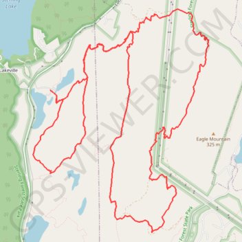
Sterling Forest State Park
Mountain Bike Ride
- Distance: 20.2 Km
- Elevation gain: 468 m
- Maximum elevation: 334 m
- Elevation loss: 469 m
- Minimum elevation: 206 m
- Moving time: 2 h 27 m
- Moving speed: 8.2 Km/h
- Maximum speed: 25.9 Km/h
- Total time: 2 h 39 m
- Global speed: 7.6 Km/h
- Date: 2024-04-15
Interactive map
GPS track profile
About this GPS track
Name: Sterling Forest State Park GPS track, route, trail
Coordinates: 41.17458 -74.25581 41.20588 -74.22322
Other GPS tracks
Click on a GPS track to view route, its statistics and profile.
Sterling Mountain Bike Ride
United States > New York > Orange County > Town of Warwick > Lakeville
Distance: 21.2 Km • Elevation gain: 510 m • Maximum elevation: 334 m