Lac Clair
Interactive map
GPS track profile
About this GPS track
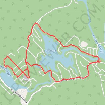
Name: Lac Clair GPS track, route, trail
Start: 4806, Chemin du Lac-Brûlé, Chertsey, Matawinie, Lanaudière, Québec, Canada (46.11499 -73.80305)
End: 4812, Chemin du Lac-Brûlé, Chertsey, Matawinie, Lanaudière, Québec, Canada (46.11478 -73.80328)
Coordinates: 46.11063 -73.83157 46.12263 -73.80305
Other GPS tracks
Click on a GPS track to view route, its statistics and profile.