Import a GPX file

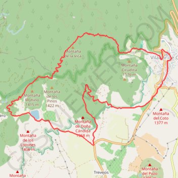
Vilaflor - Ifonche - Vilaflor

Randonnée en boucle depuis Vilaflor. #Randonnée #Boucle

  • Distance: 13.3 Km
  • Elevation gain: 507 m
  • Maximum elevation: 1,605 m
  • Elevation loss: 507 m
  • Minimum elevation: 1,254 m
  • Moving time: 3 h 52 m
  • Moving speed: 3.4 Km/h
  • Maximum speed: 5.8 Km/h
  • Total time: 4 h 39 m
  • Global speed: 2.8 Km/h
  • Date: 2013-03-26

Interactive map

GPS track profile

About this GPS track

Other GPS tracks

Click on a GPS track to view route, its statistics and profile.

Tenerife (Canary Islands) GR 131

Espagne > El Rosario > La Esperanza

#Trail #Tenerife #Volcano #Canary #Island #Nature #Mountain #Forest #Sea #Atlantic #Ocean

Distance: 87.7 Km • Elevation gain: 4,437 m • Maximum elevation: 2,404 m

LONG TRAIL GR - 131 TENERIFE (CANARY ISLANDS) GR131 GR 131|trackspotting.com

Spain > El Rosario > La Esperanza

Distance: 87.7 Km • Elevation gain: 4,437 m • Maximum elevation: 2,404 m

Paisaje lunar

Espagne > Vilaflor > Vilaflor de Chasna

En boucle depuis Vilaflor. #Boucle #meïnaelya

Distance: 13.5 Km • Elevation gain: 680 m • Maximum elevation: 1,962 m