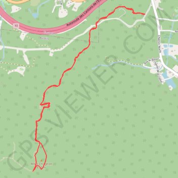
Mont Chagnon
#Hike
- Distance: 6.2 Km
- Elevation gain: 327 m
- Maximum elevation: 594 m
- Elevation loss: 327 m
- Minimum elevation: 343 m
Interactive map
GPS track profile
About this GPS track
Name: Mont Chagnon GPS track, route, trail
Coordinates: 45.27153 -72.27888 45.28801 -72.26289
Topography: Memphrémagog topographic map
Other GPS tracks
Click on a GPS track to view route, its statistics and profile.