Keyhole Trail
Interactive map
GPS track profile
About this GPS track
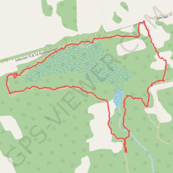
Name: Keyhole Trail GPS track, route, trail
Coordinates: 44.33206 -80.22635 44.34286 -80.20804
Topography: Clearview topographic map
Other GPS tracks
Click on a GPS track to view route, its statistics and profile.
Owen Sound - Orangeville
Canada > Ontario > Grey County > Owen Sound
Distance: 107.6 Km • Elevation gain: 593 m • Maximum elevation: 517 m