Seal Bay Loop
Interactive map
GPS track profile
About this GPS track
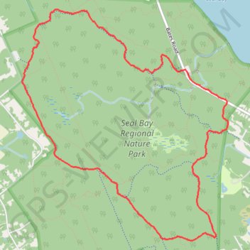
Name: Seal Bay Loop GPS track, route, trail
Coordinates: 49.74390 -124.99576 49.76621 -124.96503
Topography: Area B (Lazo North) topographic map
Other GPS tracks
Click on a GPS track to view route, its statistics and profile.
Seal Bay Loop
Canada > British Columbia > Comox Valley Regional District > Area B (Lazo North) > Waveland
Distance: 8.6 Km • Elevation gain: 96 m • Maximum elevation: 110 m