Import a GPX file

Hollyburn Peak

Cypress Provincial Park. Capilano Watershed. #Hike #Snowshoes #Ski #Loop #Cypress #Capilano

  • Distance: 7.0 Km
  • Elevation gain: 408 m
  • Maximum elevation: 1,301 m
  • Elevation loss: 408 m
  • Minimum elevation: 901 m

Interactive map

GPS track profile

About this GPS track
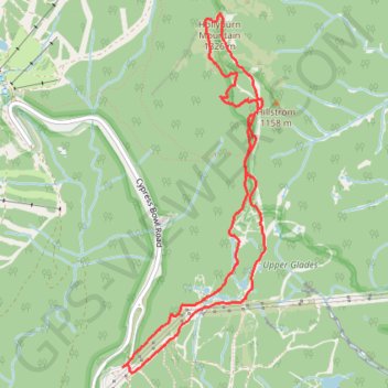
Other GPS tracks

Click on a GPS track to view route, its statistics and profile.

Mount Strachan

Canada > British Columbia > Metro Vancouver Regional District > West Vancouver

Cypress Provincial Park. #Hike #Loop #Strachan #Cypress

Distance: 8.5 Km • Elevation gain: 649 m • Maximum elevation: 1,419 m

Capilano Lake - Holyburn Peak - Black Mountain - Horseshoe Bay

Canada > British Columbia > Metro Vancouver Regional District

Cypress Provincial Park. #Hike #Capilano #Holyburn #Black #Horseshoe #Cypress

Distance: 28.3 Km • Elevation gain: 1,517 m • Maximum elevation: 1,299 m