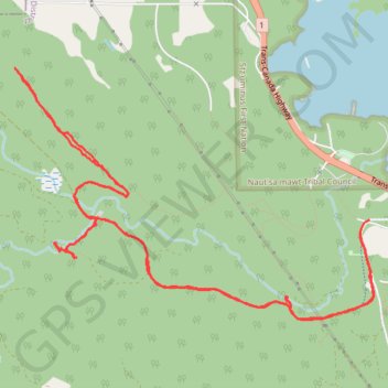
Christie Falls - Camas Ridge
#Hike
- Distance: 12.5 Km
- Elevation gain: 270 m
- Maximum elevation: 164 m
- Elevation loss: 271 m
- Minimum elevation: 23 m
Interactive map
GPS track profile
About this GPS track
Name: Christie Falls - Camas Ridge GPS track, route, trail
Coordinates: 49.00430 -123.88643 49.02138 -123.84924
Topography: Area H (North Oyster / Diamond) topographic map
Other GPS tracks
Click on a GPS track to view route, its statistics and profile.