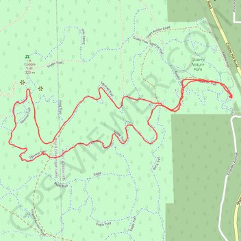
Cobble Hill Mountain Regional Recreation Area
#Hike #Loop #CobbleHill
- Distance: 3.6 Km
- Elevation gain: 223 m
- Maximum elevation: 314 m
- Elevation loss: 223 m
- Minimum elevation: 101 m
Interactive map
GPS track profile
About this GPS track
Name: Cobble Hill Mountain Regional Recreation Area GPS track, route, trail
Coordinates: 48.68452 -123.61895 48.68785 -123.60524
Topography: Area C (Cobble Hill) topographic map
Other GPS tracks
Click on a GPS track to view route, its statistics and profile.
Cobble Hill Loop
Canada > British Columbia > Cowichan Valley Regional District > Area C (Cobble Hill) > Cobble Hill
Cobble Hill Mountain Regional Recreation Area. #Hike #MTB #Loop #CobbleHill
Distance: 7.2 Km • Elevation gain: 325 m • Maximum elevation: 320 m