GPS tracks, routes, trails, hikes

GPS tracks visualization and sharing, free and without registration.

Import a GPX file

Scout Tract Regional Forest

#Hike #Loop

  • Distance: 3.5 Km
  • Elevation gain: 40 m
  • Maximum elevation: 323 m
  • Elevation loss: 40 m
  • Minimum elevation: 285 m

Interactive map

GPS track profile

About this GPS track

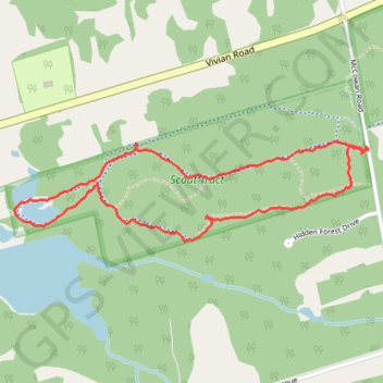
Name: Scout Tract Regional Forest GPS track, route, trail.
Start: 16552, McCowan Road, Whitchurch-Stouffville, York Region, Golden Horseshoe, Ontario, L3Y 4W1, Canada (44.06494 -79.32892)
End: 16552, McCowan Road, Whitchurch-Stouffville, York Region, Golden Horseshoe, Ontario, L3Y 4W1, Canada (44.06494 -79.32892)
Coordinates: 44.06195 -79.34519 44.06528 -79.32872

Other GPS tracks

Québec - Montréal - Saint-Laurent River - Lake Ontario - Niagara Falls

Canada > Quebec > Québec (Agglomération) > Quebec City

#Bike #Ontario

Distance: 1,078.4 Km - Elevation gain: 4,847 m - Maximum elevation: 208 m - Coordinates: 43.08778 -79.89248 46.82520 -71.19960

Start: 114, 10e Rue, Limoilou, Vieux-Limoilou, La Cité-Limoilou, Quebec City, Québec (Agglomération), Capitale-Nationale, Quebec, G1L 2X2, Canada (46.82514 -71.23278)

End: Military Road, Pletchers Corners, Niagara Town, Niagara County, New York, 14092, United States (43.11863 -78.99575)