Lupin Falls Nature Walk
Buttle Lake. Strathcona Provincial Park. Vancouver Island. #Hike #Loop #Buttle #Strathcona #Vancouver
- Distance: 0.8 Km
- Elevation gain: 59 m
- Maximum elevation: 299 m
- Elevation loss: 59 m
- Minimum elevation: 245 m
Interactive map
GPS track profile
About this GPS track
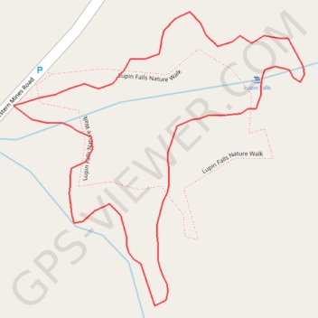
Name: Lupin Falls Nature Walk GPS track, route, trail
Coordinates: 49.79731 -125.59811 49.79919 -125.59523
Topography: Area D (Oyster Bay/Buttle Lake) topographic map