Eaton Falls
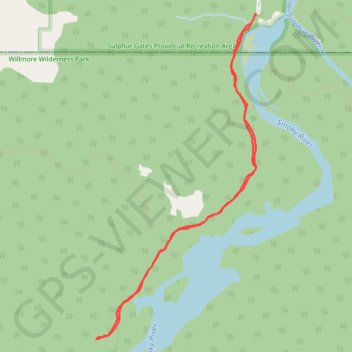
Sulphur Gates Provincial Recreation Area. Willmore Wilderness Park. Smoky River. #Hike #SulphurGates #Willmore
- Distance: 7.1 Km
- Elevation gain: 288 m
- Maximum elevation: 1,074 m
- Elevation loss: 288 m
- Minimum elevation: 983 m
Interactive map
GPS track profile
About this GPS track
Name: Eaton Falls GPS track, route, trail
Start: Kvass Flats Trail, Municipal District of Greenview, Alberta, Canada (53.84964 -119.18637)
End: Kvass Flats Trail, Municipal District of Greenview, Alberta, Canada (53.84964 -119.18637)
Coordinates: 53.82509 -119.20680 53.84964 -119.18630
Topography: Municipal District of Greenview topographic map