Import a GPX file

Mount Tallac

Desolation Wilderness. Lake Tahoe, Fallen Leaf Lake, Floating Island Lake, Cathedral Lake. #Hike #Snowshoes #Mountain #Lake #Forest #Nature

  • Distance: 16.1 Km
  • Elevation gain: 1,014 m
  • Maximum elevation: 2,959 m
  • Elevation loss: 1,014 m
  • Minimum elevation: 1,966 m

Interactive map

GPS track profile

About this GPS track
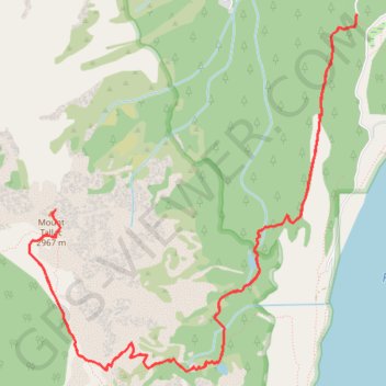
Other GPS tracks

Click on a GPS track to view route, its statistics and profile.

Cathedral Lake and Floating Island Lake

United States > California > El Dorado County > Spring Creek

Hike to Cathedral Lake and Floating Island Lake via Mount Tallac Trail above the Fallen Leaf Lake in the Desolation Wilderness. #Hike #Nature #Lake #Mountain #Forest #Wilderness

Distance: 8.8 Km • Elevation gain: 368 m • Maximum elevation: 2,328 m

Chester - Walker

États-Unis d'Amérique > Californie > Plumas County > Chester

Vélo. En aller simple entre Chester et Walker. #Vélo

Distance: 383.8 Km • Elevation gain: 6,088 m • Maximum elevation: 2,541 m