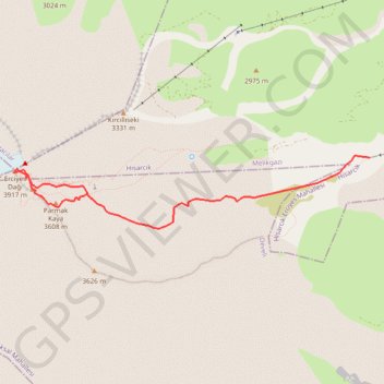
Erciyès (Turquie)
Ski. #Ski
- Distance: 6.3 Km
- Elevation gain: 1,125 m
- Maximum elevation: 3,877 m
- Elevation loss: 531 m
- Minimum elevation: 2,769 m
- Moving time: 3 h 1 m
- Moving speed: 2.1 Km/h
- Maximum speed: 7.8 Km/h
- Total time: 5 h 51 m
- Global speed: 1.1 Km/h
- Date: 2010-04-03
Interactive map
GPS track profile
About this GPS track
Name: Erciyès (Turquie) GPS track, route, trail
Coordinates: 38.52625 35.44890 38.53348 35.49395
Other GPS tracks
Click on a GPS track to view route, its statistics and profile.
Turkish port to Turkish border (Next to van)
Distance: 1,773.2 Km • Elevation gain: 19,471 m • Maximum elevation: 2,511 m