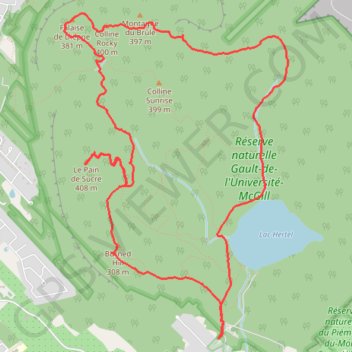
Randonnée au Centre de la Nature Mont Saint-Hilaire
- Distance: 11.8 Km
- Elevation gain: 478 m
- Maximum elevation: 392 m
- Elevation loss: 478 m
- Minimum elevation: 133 m
Interactive map
GPS track profile
About this GPS track
Name: Randonnée au Centre de la Nature Mont Saint-Hilaire GPS track, route, trail
Coordinates: 45.53656 -73.17486 45.56230 -73.14955
Other GPS tracks
Click on a GPS track to view route, its statistics and profile.
Pierreville - Leclercville
Canada > Quebec > Urban agglomeration of Montreal > Montreal
#Bike #Pierreville #Leclercville #Atlantic
Distance: 120.8 Km • Elevation gain: 324 m • Maximum elevation: 36 m