Bridge to Nowhere
Interactive map
GPS track profile
About this GPS track
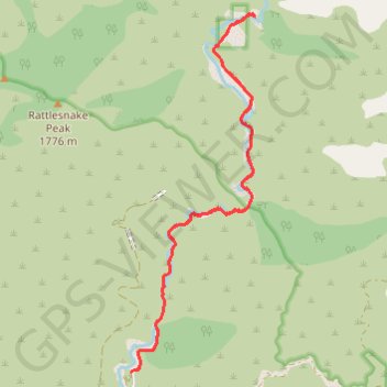
Name: Bridge to Nowhere GPS track, route, trail
Start: Camp Bonita Road, Los Angeles County, California, United States (34.23696 -117.76546)
End: Camp Bonita Road, Los Angeles County, California, United States (34.23696 -117.76546)
Coordinates: 34.23696 -117.76546 34.28335 -117.74597
Other GPS tracks
Click on a GPS track to view route, its statistics and profile.
Return from Bridge to Nowhere
United States > California > Los Angeles County
Distance: 7.8 Km • Elevation gain: 222 m • Maximum elevation: 875 m
Bridge to Nowhere
United States > California > Los Angeles County
Distance: 15.4 Km • Elevation gain: 563 m • Maximum elevation: 864 m