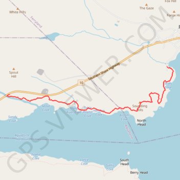
East Coast Trail - Sounding Hills Path
- Distance: 5.0 Km
- Elevation gain: 224 m
- Maximum elevation: 92 m
- Elevation loss: 194 m
- Minimum elevation: 2 m
Interactive map
GPS track profile
About this GPS track
Name: East Coast Trail - Sounding Hills Path GPS track, route, trail
Coordinates: 47.00885 -52.93363 47.01705 -52.89064
Topography: Aquaforte topographic map