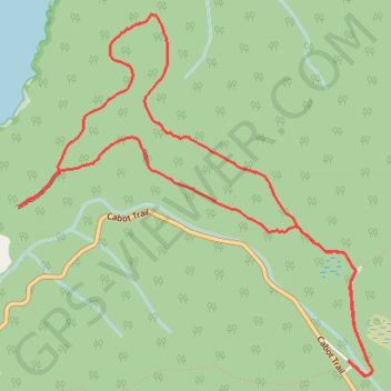
Cape Breton Island - Skyline Trail
#Hike #Loop #CapeBreton
- Distance: 9.4 Km
- Elevation gain: 211 m
- Maximum elevation: 403 m
- Elevation loss: 211 m
- Minimum elevation: 249 m
Interactive map
GPS track profile
About this GPS track
Name: Cape Breton Island - Skyline Trail GPS track, route, trail
Coordinates: 46.73721 -60.91088 46.75950 -60.87905
Topography: Cape Breton Highlands National Park topographic map