Assiniboine Lodge - Mount Shark
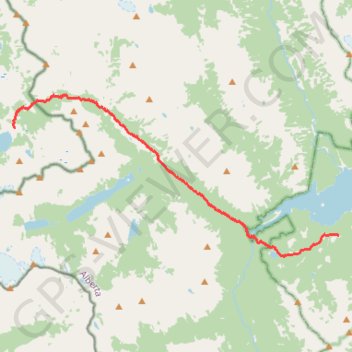
Interactive map
GPS track profile
About this GPS track
Name: Assiniboine Lodge - Mount Shark GPS track, route, trail
End: Watridge Lake Trail, Division No. 15, Alberta, Canada (50.85934 -115.37916)
Coordinates: 50.84967 -115.62167 50.92536 -115.37916
Topography: Area G (Forster Creek/Mount Assiniboine) topographic map
Other GPS tracks
Click on a GPS track to view route, its statistics and profile.
Assiniboine Lodge - The Nublet - Nub Peak - Elizabeth lake - Sunburst Valley - Cerulean Lake
Canada > British Columbia > Regional District of East Kootenay > Area G (Forster Creek/Mount Assiniboine)
Mount Assiniboine Provincial Park. #Hike #Loop #Assiniboine
Distance: 12.5 Km • Elevation gain: 735 m • Maximum elevation: 2,738 m