Bradford - Wasaga Beach
Interactive map
GPS track profile
About this GPS track
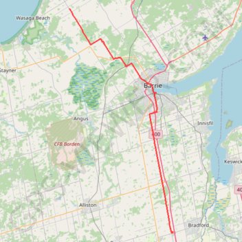
Name: Bradford - Wasaga Beach GPS track, route, trail
Coordinates: 44.09773 -79.91948 44.53876 -79.63542
Topography: Simcoe County topographic map
Other GPS tracks
Click on a GPS track to view route, its statistics and profile.
Wasaga Beach - Orillia
Canada > Ontario > Simcoe County > Wasaga Beach
Distance: 81.4 Km • Elevation gain: 450 m • Maximum elevation: 343 m