Sioux Narrows - Nestor Falls
Interactive map
GPS track profile
About this GPS track
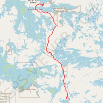
Name: Sioux Narrows - Nestor Falls GPS track, route, trail
Coordinates: 49.05766 -94.09829 49.42943 -93.90407
Topography: Sioux Narrows-Nestor Falls Township topographic map
Other GPS tracks
Click on a GPS track to view route, its statistics and profile.
Nestor Falls - Fort Frances
Canada > Ontario > Kenora District > Sioux Narrows-Nestor Falls Township
#Bike
Distance: 94.1 Km • Elevation gain: 431 m • Maximum elevation: 395 m