Creston - Cranbrook
Interactive map
GPS track profile
About this GPS track
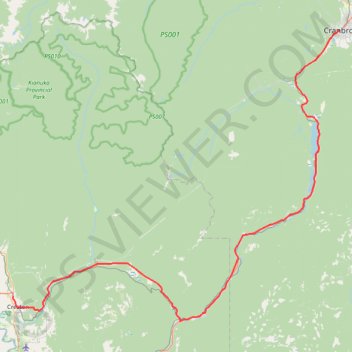
Name: Creston - Cranbrook GPS track, route, trail
Coordinates: 49.07500 -116.52355 49.50859 -115.77597
Topography: Regional District of Central Kootenay topographic map
Other GPS tracks
Click on a GPS track to view route, its statistics and profile.
Départ - Alberta
Canada > Colombie-Britannique > District régional du Grand Vancouver > Vancouver
Distance: 2,596.8 Km • Elevation gain: 17,360 m • Maximum elevation: 2,042 m
Crawford Bay - Creston
Canada > British Columbia > Regional District of Central Kootenay > Area A (Wynndel/Crawford Bay/Riondel) > Crawford Bay
Kootenay Lake. #Bike
Distance: 76.8 Km • Elevation gain: 1,016 m • Maximum elevation: 681 m