Import a GPX file

Cranbrook - Fernie

#Bike #Cranbrook #Fernie

  • Distance: 100.2 Km
  • Elevation gain: 768 m
  • Maximum elevation: 1,004 m
  • Elevation loss: 688 m
  • Minimum elevation: 746 m

Interactive map

GPS track profile

About this GPS track
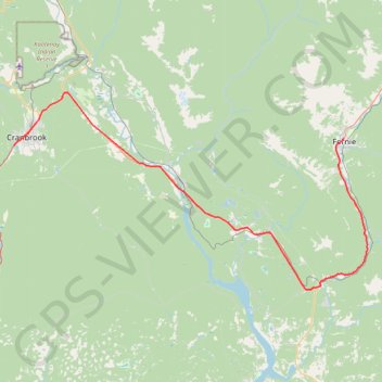
Other GPS tracks

Click on a GPS track to view route, its statistics and profile.

Départ - Alberta

Canada > Colombie-Britannique > District régional du Grand Vancouver > Vancouver

Distance: 2,596.8 Km • Elevation gain: 17,360 m • Maximum elevation: 2,042 m

Creston - Cranbrook

Canada > British Columbia > Regional District of Central Kootenay > Creston

#Bike #Creston #Cranbrook

Distance: 107.1 Km • Elevation gain: 1,009 m • Maximum elevation: 1,003 m

Fernie - Blairmore

Canada > British Columbia > Regional District of East Kootenay > Fernie

#Bike #Fernie #Blairmore

Distance: 68.2 Km • Elevation gain: 682 m • Maximum elevation: 1,393 m

Fairy Creek Waterfall Trail

Canada > British Columbia > Regional District of East Kootenay > Fernie

#Hike #MTB #Snowshoes #Forest #Falls

Distance: 4.5 Km • Elevation gain: 148 m • Maximum elevation: 1,083 m