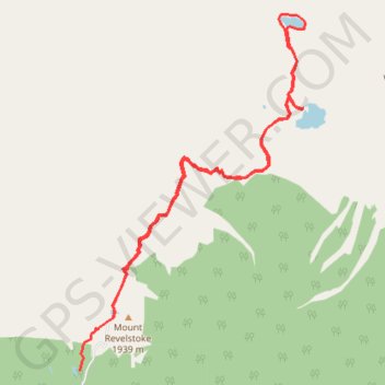
Meadows in the Sky - Eva Lake - Miller Lake
Mount Revelstoke National Park. #Hike #Revelstoke
- Distance: 14.4 Km
- Elevation gain: 570 m
- Maximum elevation: 1,962 m
- Elevation loss: 652 m
- Minimum elevation: 1,790 m
Interactive map
GPS track profile
About this GPS track
Name: Meadows in the Sky - Eva Lake - Miller Lake GPS track, route, trail
Coordinates: 51.04073 -118.14832 51.08238 -118.10646
Topography: Area B (Shelter Bay/Mica Creek) topographic map
Other GPS tracks
Click on a GPS track to view route, its statistics and profile.