Rattlesnake Trail
#Hike
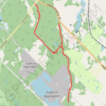
- Distance: 17.3 Km
- Elevation gain: 208 m
- Maximum elevation: 343 m
- Elevation loss: 207 m
- Minimum elevation: 307 m
Interactive map
GPS track profile
About this GPS track
Name: Rattlesnake Trail GPS track, route, trail
Coordinates: 43.53224 -79.97741 43.57787 -79.95345
Topography: Halton Region topographic map
Other GPS tracks
Click on a GPS track to view route, its statistics and profile.
Dufferin Quarry Bridge - Bruce Trail
Canada > Ontario > Halton Region > Milton
#Hike
Distance: 10.3 Km • Elevation gain: 204 m • Maximum elevation: 328 m