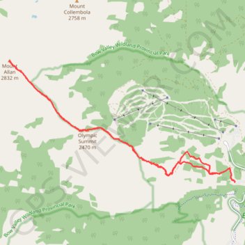
Olympic Summit - Mount Allan
Interactive map
GPS track profile
About this GPS track
Name: Olympic Summit - Mount Allan GPS track, route, trail
Start: Parking Ribbon Creek, Terrace Trail, Division No. 15, Alberta, Canada (50.93317 -115.14758)
End: Parking Ribbon Creek, Terrace Trail, Division No. 15, Alberta, Canada (50.93315 -115.14766)
Coordinates: 50.93261 -115.22479 50.95935 -115.14729
Topography: Division No. 15 topographic map
Other GPS tracks
Click on a GPS track to view route, its statistics and profile.
Ribbon Creek Loop
Canada > Alberta > Division No. 15
Evan-Thomas Provincial Recreation Area. Spray Valley Provincial Park. #Hike #Loop #EvanThomas #SprayValley
Distance: 5.6 Km • Elevation gain: 154 m • Maximum elevation: 1,589 m