Moncton - Amherst
Interactive map
GPS track profile
About this GPS track
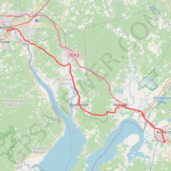
Name: Moncton - Amherst GPS track, route, trail
Coordinates: 45.80139 -64.78492 46.09514 -64.19895
Topography: Moncton topographic map
Other GPS tracks
Click on a GPS track to view route, its statistics and profile.
Coles Island - Moncton
Canada > New Brunswick > Johnston Parish
Distance: 90.9 Km • Elevation gain: 587 m • Maximum elevation: 135 m
Amherst - Brookfield
Canada > Nova Scotia > Municipality of the County of Cumberland > Upper Nappan
Distance: 121.3 Km • Elevation gain: 1,019 m • Maximum elevation: 255 m
Dieppe Run
Canada > Nouveau-Brunswick > Moncton Parish > Dieppe
Distance: 6.0 Km • Elevation gain: 56 m • Maximum elevation: 51 m