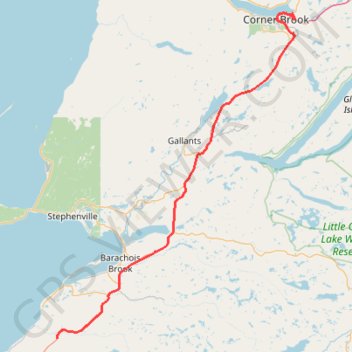
Robinson's Junction - Corner Brook
- Distance: 111.3 Km
- Elevation gain: 1,156 m
- Maximum elevation: 314 m
- Elevation loss: 1,235 m
- Minimum elevation: 0 m
Interactive map
GPS track profile
About this GPS track
Name: Robinson's Junction - Corner Brook GPS track, route, trail
Start: Trans Canada Highway, Newfoundland, Newfoundland and Labrador, Canada (48.28876 -58.63520)
Coordinates: 48.28876 -58.63520 48.96578 -57.88637
Topography: Newfoundland and Labrador topographic map
Other GPS tracks
Click on a GPS track to view route, its statistics and profile.
Corner Brook - Deer Lake
Canada > Newfoundland and Labrador > Corner Brook
#Bike #CornerBrook #Deer #Newfoundland
Distance: 64.2 Km • Elevation gain: 446 m • Maximum elevation: 137 m