GPS tracks, routes, trails, hikes

GPS tracks visualization and sharing, free and without registration.

Import a GPX file

Brandon - Sidney

#Bike #Brandon #Sidney

  • Distance: 66.4 Km
  • Elevation gain: 101 m
  • Maximum elevation: 407 m
  • Elevation loss: 130 m
  • Minimum elevation: 374 m

Interactive map

GPS track profile

About this GPS track

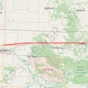
Name: Brandon - Sidney GPS track, route, trail.
Start: Meadowlark Trailer Court, Brandon, Manitoba, R7C 1A7, Canada (49.88747 -99.95569)
End: Sidney, Manitoba, Canada (49.90255 -99.05858)
Coordinates: 49.88680 -99.95570 49.90255 -99.05858

Other GPS tracks

Sidney - Portage la Prairie

Canada > Manitoba > Sidney

#Bike #Sidney #PortageLaPrairie

Distance: 59.1 Km - Elevation gain: 38 m - Maximum elevation: 378 m - Coordinates: 49.90255 -99.05858 49.97487 -98.29060

Start: Sidney, Manitoba, Canada (49.90255 -99.05858)

End: Parish Lot, Portage la Prairie, Manitoba, R1N 1T8, Canada (49.96572 -98.29936)

Virden - Brandon

Canada > Manitoba > Rural Municipality of Wallace-Woodworth > Virden

#Bike #Virden #Brandon

Distance: 79.7 Km - Elevation gain: 143 m - Maximum elevation: 445 m - Coordinates: 49.76886 -100.93331 49.88747 -99.95569

Start: Virden Collegiate Institute, Government Road South, Virden, Rural Municipality of Wallace-Woodworth, Manitoba, R0M 2C0, Canada (49.84253 -100.92484)

End: Meadowlark Trailer Court, Brandon, Manitoba, R7C 1A7, Canada (49.88747 -99.95569)