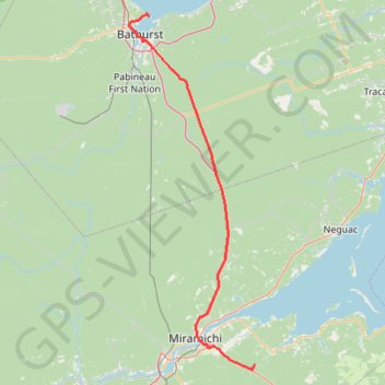
Bathurst - Black River Bridge
#Bike #Bathurst #BlackRiverBridge
- Distance: 99.9 Km
- Elevation gain: 656 m
- Maximum elevation: 163 m
- Elevation loss: 629 m
- Minimum elevation: -2 m
Interactive map
GPS track profile
About this GPS track
Name: Bathurst - Black River Bridge GPS track, route, trail
Coordinates: 46.96902 -65.68305 47.66431 -65.32072
Topography: Bathurst topographic map
Other GPS tracks
Click on a GPS track to view route, its statistics and profile.
Campbellton - Bathurst
Canada > Quebec > Avignon > Pointe-à-la-Croix > Cross Point Station
Ristigouche River. Gulf of Saint Lawrence. #Bike #Campbellton #Bathurst #Ristigouche #SaintLawrence
Distance: 119.2 Km • Elevation gain: 668 m • Maximum elevation: 69 m
Black River Bridge - Shédiac
Canada > New Brunswick > Glenelg Parish
Gulf of Saint Lawrence. #Bike #SaintLawrence #Atlantic
Distance: 114.8 Km • Elevation gain: 451 m • Maximum elevation: 37 m