De San Giovanni Rotondo au monastère Santa Maria de Stignano
Randonnée entre San Giovanni Rotondo et Stignano. #Randonnée
- Distance: 19.5 Km
- Elevation gain: 568 m
- Maximum elevation: 936 m
- Elevation loss: 952 m
- Minimum elevation: 267 m
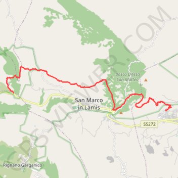
Interactive map
GPS track profile
About this GPS track
Name: De San Giovanni Rotondo au monastère Santa Maria de Stignano GPS track, route, trail
Start: Via Valle Oscura, San Giovanni Rotondo, Foggia, Pouilles, 71013, Italie (41.70893 15.70056)
Coordinates: 41.70880 15.57506 41.73451 15.70485
Other GPS tracks
Click on a GPS track to view route, its statistics and profile.
Percorso selezionato
Italie > Lombardie > Côme > Côme
Percorso calcolato con http://www.bicitalia.org/it/routing-gpx
Distance: 1,543.9 Km • Elevation gain: 17,951 m • Maximum elevation: 1,034 m
Du monastère Santa Maria de Stignano à Torremaggiore
Italie > Pouilles > Foggia > Rignano Garganico
Randonnée entre Stignano et Torremaggiore. #Randonnée
Distance: 27.0 Km • Elevation gain: 173 m • Maximum elevation: 270 m