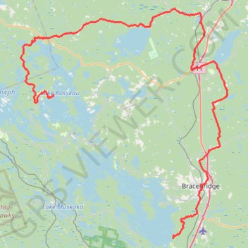
Lake Muskoka - Lake Rosseau
#Bike
- Distance: 105.5 Km
- Elevation gain: 1,294 m
- Maximum elevation: 344 m
- Elevation loss: 1,296 m
- Minimum elevation: 223 m
Interactive map
GPS track profile
About this GPS track
Name: Lake Muskoka - Lake Rosseau GPS track, route, trail
Coordinates: 44.96372 -79.68444 45.29987 -79.25529
Topography: Muskoka District topographic map
Other GPS tracks
Click on a GPS track to view route, its statistics and profile.