Maligne Lake - Bald Hills
Interactive map
GPS track profile
About this GPS track
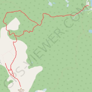
Name: Maligne Lake - Bald Hills GPS track, route, trail
Start: Skyline Trail, Division No. 15, Alberta, Canada (52.72576 -117.64560)
End: Maligne Lake road, Division No. 15, Alberta, Canada (52.72594 -117.64431)
Coordinates: 52.69755 -117.69346 52.72594 -117.64431
Topography: Division No. 15 topographic map
Other GPS tracks
Click on a GPS track to view route, its statistics and profile.