Uniacke, Clarcke and Thompson Lakes Loop
Interactive map
GPS track profile
About this GPS track
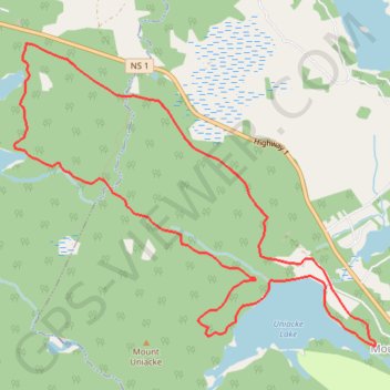
Name: Uniacke, Clarcke and Thompson Lakes Loop GPS track, route, trail
Coordinates: 44.89578 -63.87349 44.91732 -63.83728
Topography: Hants County topographic map, elevation, terrain
Other GPS tracks
Click on a GPS track to view its route, statistics and profile.
Red Spruce Trail
Canada > Nova Scotia > Hants County > Mount Uniacke
Distance: 2.8 Km • Elevation gain: 50 m • Maximum elevation: 193 m