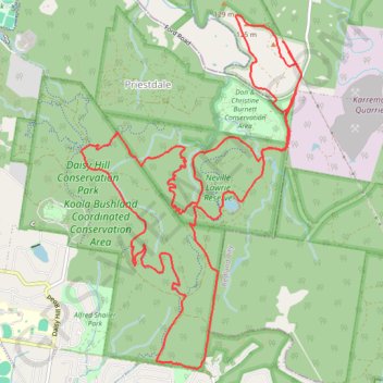
Daisy Hill / Koala Bushland / Neville Lawrie Loop
Loop hike / run through Daisy Hill Conservation Park, Koala Bushland Coordinated Conservation Area and Neville Lawrie Reserve. #Hike #Run #Loop #Nature #Forest #River #Lake #Park
- Distance: 22.1 Km
- Elevation gain: 410 m
- Maximum elevation: 120 m
- Elevation loss: 410 m
- Minimum elevation: 37 m
- Moving time: 2 h 52 m
- Moving speed: 7.7 Km/h
- Maximum speed: 20.1 Km/h
- Total time: 2 h 54 m
- Global speed: 7.6 Km/h
- Date: 2024-02-03
Interactive map
GPS track profile
About this GPS track
Name: Daisy Hill / Koala Bushland / Neville Lawrie Loop GPS track, route, trail
Coordinates: -27.63838 153.15833 -27.60033 153.18507
Other GPS tracks
Click on a GPS track to view route, its statistics and profile.