Owen Sound - Wasaga Beach
Lake Huron. Georgian Bay. #Bike #Lake #Countryside #Town #Nature
- Distance: 77.7 Km
- Elevation gain: 320 m
- Maximum elevation: 351 m
- Elevation loss: 315 m
- Minimum elevation: 177 m
Interactive map
GPS track profile
About this GPS track
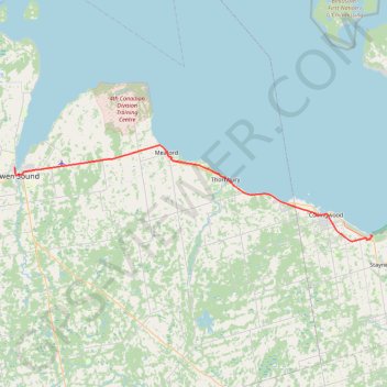
Name: Owen Sound - Wasaga Beach GPS track, route, trail
Coordinates: 44.45674 -80.94698 44.61884 -80.10737
Topography: Owen Sound topographic map
Other GPS tracks
Click on a GPS track to view route, its statistics and profile.
Wasaga Beach - Orillia
Canada > Ontario > Simcoe County > Wasaga Beach
Distance: 81.4 Km • Elevation gain: 450 m • Maximum elevation: 343 m
Owen Sound - Orangeville
Canada > Ontario > Grey County > Owen Sound
Distance: 107.6 Km • Elevation gain: 593 m • Maximum elevation: 517 m