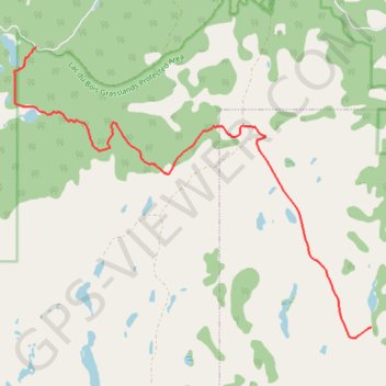
Route
- Distance: 11.2 Km
- Elevation gain: 143 m
- Maximum elevation: 1,008 m
- Elevation loss: 556 m
- Minimum elevation: 582 m
Interactive map
GPS track profile
About this GPS track
Name: Route GPS track, route, trail
Coordinates: 50.78993 -120.42706 50.83155 -120.34627
Topography: Area J (Copper Desert Country) topographic map
Other GPS tracks
Click on a GPS track to view route, its statistics and profile.
Cache Creek - Kamloops
Canada > British Columbia > Thompson-Nicola Regional District > Cache Creek
Distance: 86.9 Km • Elevation gain: 1,114 m • Maximum elevation: 736 m
Route
Canada > British Columbia > Thompson-Nicola Regional District > Kamloops
Distance: 3.1 Km • Elevation gain: 159 m • Maximum elevation: 583 m