Notre-Dame Camping - L'Amicale Camping
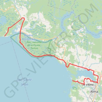
Lake Saint-Jean. #Bike #Loop #SaintJean #Piékouagami
- Distance: 81.7 Km
- Elevation gain: 493 m
- Maximum elevation: 148 m
- Elevation loss: 493 m
- Minimum elevation: 93 m
Interactive map
GPS track profile
About this GPS track
Name: Notre-Dame Camping - L'Amicale Camping GPS track, route, trail
Coordinates: 48.57504 -72.14375 48.81400 -71.62928
Topography: Alma topographic map