Campbell River - Sayward
Interactive map
GPS track profile
About this GPS track
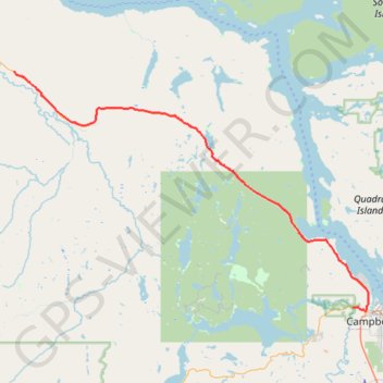
Name: Campbell River - Sayward GPS track, route, trail
Coordinates: 50.03307 -125.87598 50.29636 -125.26904
Topography: Campbell River topographic map
Other GPS tracks
Click on a GPS track to view route, its statistics and profile.
Elk Falls Provincial Park Campground Loop via Millenium trail
Canada > British Columbia > Strathcona Regional District > Campbell River
Distance: 13.8 Km • Elevation gain: 413 m • Maximum elevation: 160 m