Marymere Falls
Interactive map
GPS track profile
About this GPS track
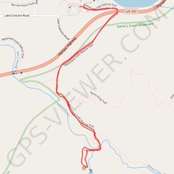
Name: Marymere Falls GPS track, route, trail
Start: Marymere Falls Nature Trail, Clallam County, Washington, United States (48.05808 -123.78914)
End: Marymere Falls Nature Trail, Clallam County, Washington, United States (48.05808 -123.78914)
Coordinates: 48.05047 -123.79078 48.05808 -123.78643
Other GPS tracks
Click on a GPS track to view route, its statistics and profile.