Aurigny (Ile anglo-normande)
Interactive map
GPS track profile
About this GPS track
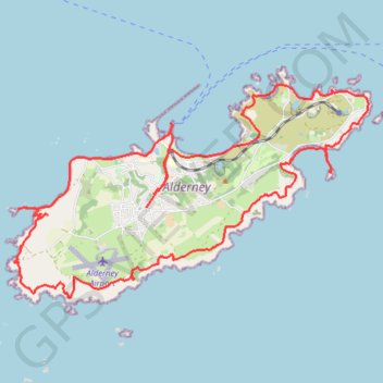
Name: Aurigny (Ile anglo-normande) GPS track, route, trail
Start: Braye Street, Braye, Aurigny, GY9 3XT, Guernesey (49.72507 -2.20013)
End: Braye Street, Braye, Aurigny, GY9 3XT, Guernesey (49.72528 -2.20022)
Coordinates: 49.70200 -2.23248 49.73038 -2.15968
Other GPS tracks
Click on a GPS track to view route, its statistics and profile.
Tour d'Europe
France > Bretagne > Finistère > Concarneau > Landan Creis
Distance: 7,132.9 Km • Elevation gain: 44,603 m • Maximum elevation: 2,433 m
Itinéraire de Nemours à Nemours
France > Centre-Val de Loire > Loiret > Bromeilles > Bainvilliers
Distance: 1,576.4 Km • Elevation gain: 8,536 m • Maximum elevation: 238 m