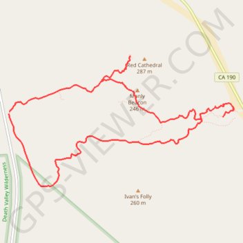
Red Cathedral and Zabriskie Point Loop
Loop hike to Red Cathedral and Zabriskie Point via the Golden Canyon Trail, the Gower Gulch Trail and Badlands Loop in the Death Valley National Park. #Hike #Loop #Mountain #Nature #Desert #Park
- Distance: 11.6 Km
- Elevation gain: 417 m
- Maximum elevation: 205 m
- Elevation loss: 419 m
- Minimum elevation: -50 m
Interactive map
GPS track profile
About this GPS track
Name: Red Cathedral and Zabriskie Point Loop GPS track, route, trail
End: Gower Gulch Trail, Inyo County, California, 92328, United States (36.42045 -116.84674)
Coordinates: 36.41103 -116.84674 36.42792 -116.81055
Other GPS tracks
Click on a GPS track to view route, its statistics and profile.