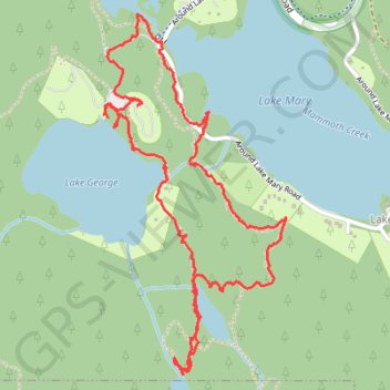
Mammoth Lakes Loop
Loop hike via Lake Mary, Lake Barret, T J Lake, Lake George, Lake Mamie and Mammoth Creek in the Inyo National Forest. #Hike #Loop #Lake #Forest #Nature #River #Mountain
- Distance: 5.4 Km
- Elevation gain: 159 m
- Maximum elevation: 2,842 m
- Elevation loss: 156 m
- Minimum elevation: 2,715 m
- Moving time: 1 h 18 m
- Moving speed: 4.1 Km/h
- Maximum speed: 36.7 Km/h
- Total time: 1 h 39 m
- Global speed: 3.2 Km/h
- Date: 2018-07-27
Interactive map
GPS track profile
About this GPS track
Name: Mammoth Lakes Loop GPS track, route, trail
Coordinates: 37.59359 -119.01148 37.60622 -119.00340
Other GPS tracks
Click on a GPS track to view route, its statistics and profile.
JMT1-16847633
États-Unis d'Amérique > Californie > Inyo County
Distance: 401.4 Km • Elevation gain: 15,190 m • Maximum elevation: 4,385 m