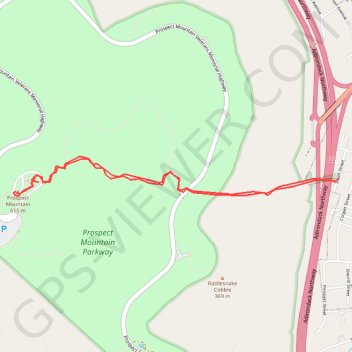
Prospect Mountain
Hike to Prospect Mountain via East Trail in the Lake George Wild Forest and the Prospect Mountain Parkway. #Hike #Mountain #Nature #Forest
- Distance: 5.3 Km
- Elevation gain: 497 m
- Maximum elevation: 610 m
- Elevation loss: 499 m
- Minimum elevation: 136 m
- Moving time: 1 h 55 m
- Moving speed: 2.8 Km/h
- Maximum speed: 4.1 Km/h
- Total time: 1 h 57 m
- Global speed: 2.7 Km/h
- Date: 2022-10-04
Interactive map
GPS track profile
About this GPS track
Name: Prospect Mountain GPS track, route, trail
Coordinates: 43.42452 -73.74605 43.42684 -73.71995
Other GPS tracks
Click on a GPS track to view route, its statistics and profile.
Montréal - New York
Canada > Québec > Agglomération de Montréal > Montréal
Distance: 637.3 Km • Elevation gain: 4,134 m • Maximum elevation: 301 m